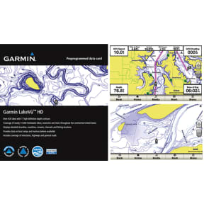
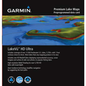


Description
With maps of more than 17,000 U.S. lakes, this HD-mapping product brings new levels of detail to your chartplotter.
• Contains more than 6,700 HD lakes with 1-foot contours throughout to help you pinpoint the best places to find fish
• Displays points of interests, including docks, designated fishing areas, campgrounds, boat ramps, marinas and bridges
• Shows interstates, highways and general roads
• Shows underwater features, such as riverbeds, bridges, roads, fish attractors and potential hazards
• Offers Safety Shading, which lets you input and shade a minimum depth to help you avoid running aground
• Features detailed coverage of more than 17,000 freshwater lakes, reservoirs and rivers throughout the continental U.S.
Compatible with the following units: GPSMAP® 62, 64, 78, 421, 431, 441, 451, 521, 527, 531, 541, 547, 551, 526, 536, 546, 556, 720, 740, 750, 820, 840, 1020, 1040, 4000, 5000, 6000, 7000, 8000, echoMAP™ 40, 50, 70 and 90, Monterra™, Montana® 600 and Oregon® 600 series devices. Software update may be required to support LakeVü HD mapping. Requires a device with a microSD/SD carld slot.
Specifications
753759997489