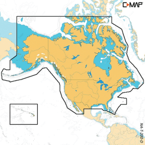

C-MAP DISCOVER X: M-NA-T-200-D-MS North America
- MicroSD Card Format
- Full-Featured Vector Charts
- Tides & Currents
Description
Important Information: This item is not returnable. If you're not sure which version you need, contact customer service and we can help you find the right option for your chartplotter.
Compatible with SIMRAD® NSX®, NSX ULTRAWIDE and B&G® Zeus® S
Discover X North America microSD Format Bathymetric Electronic Charts by C-MAP®. Uuncover everything necessary to optimize your experience on the water. Comprehensive Vector Charts featuring High-Resolution Bathymetry, along with integrated Genesis® social data, subscription-free Easy Routing™, and Custom Depth Shading. Experience the water from your perspective with C-MAP.
Full-Featured Vector Charts
Full-Featured Vector charts make navigation easy by giving you accurate, up-to-date vector chart detail derived from official Hydrographic Office information.
Hi-Res Bathymetry Layer
High-Res Bathymetry (HRB) Layer helps you identify shallow areas, drop offs, ledges, holes or humps by accurate contour lines down to 1-foot level of detail. Includes the very best of C-MAP HRB data, including C-MAP Team Lake Surveys (US only) and Genesis® social maps, quality controlled and fully integrated.
Custom Depth Shading
Custom Depth Shading allows you to set a safety depth, maintain a paper-like view or set your own custom shading – see things your way.
Easy Routing
Easy Routing helps you automatically plot the shortest, safest route based on detailed chart data and your personalized vessel information. With C-MAP Easy Routing is always subscription free.
Tides & Currents
Tides & Currents show projections of water level and direction of tides to help plan your day out, whether cruiting, angling or sailing.
Detailed Marina Port Plans
Docking in an unfamiliar port is no problem, when you have precise layouts of thousands of marinas, including slip spaces, restricted areas, and other valuable navigation information.
Next-Generation Charts
Refreshed chart presentation, with full-featured vector data and rich features
Intuitive Map Inspector Tool
Quickly see information on locations, POIs, tides, channels and more, with a simple touch of the screen.
Day & Night Mode
Best-in-Class Day & Night Modes ensure best visibility in all light and weather conditions
Vegetation
The vegetation layer comes from thousands of C-MAP Genesis & Biobase user's personal sonar trips.
Bottom Hardness
Fish love hard bottoms. They feed on them, breed on them, follow their edges like roads. The new bottom hardness layer shows the location, shape and depth of hard-bottom areas (not available in all locations).
• Full Featured Vector Charts
• Tides & Currents
• Hi Res Bathymetry Layer
• Detailed Marina Port Plans
• Integrated Genesis Layer
• Custom Depth Shading
• 12 Months’ Free Updates
• Subscription-Free Easy Routing