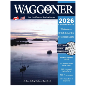


2026 Waggoner Cruising Guide - Spiral Bound
- Complete Boating Reference
- Top-selling amongst boaters
- 528 pages; over 300 maps
Description
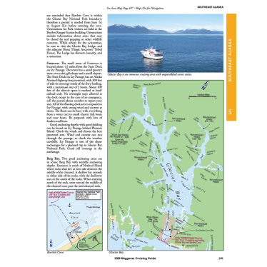
Waggoner Cruising Guide stands as the top-selling guidebook among recreational boaters in search of comprehensive details regarding marinas, anchorages, and waterways in the Pacific Northwest. This resource includes more than 300 maps and dock diagrams for convenient reference, descriptions and amenities for over 500 marinas and marine parks, as well as more than 780 prime anchorages. Additionally, crucial local insights are highlighted in red to provide alerts and ensure safe navigation.
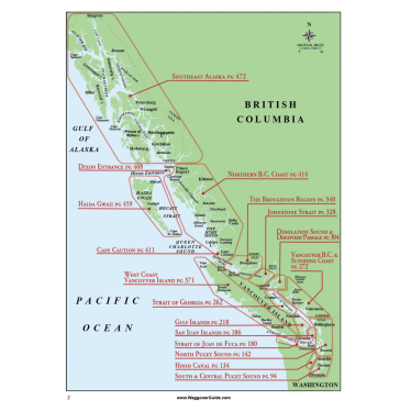
The chapters are organized by cruising regions, progressing from south to north, and encompass areas such as Puget Sound, Hood Canal, San Juan Islands, Gulf Islands, Strait of Georgia, Vancouver Island, Vancouver B.C., the Sunshine Coast, Desolation Sound & the Discovery Islands, the Broughton Region, Northern B.C. Coast, Haida Gwaii, and Southeast Alaska. Waggoner encompasses a broader geographic area than all localized guides combined, which typically range in cost from $250 to $300 for the complete set.
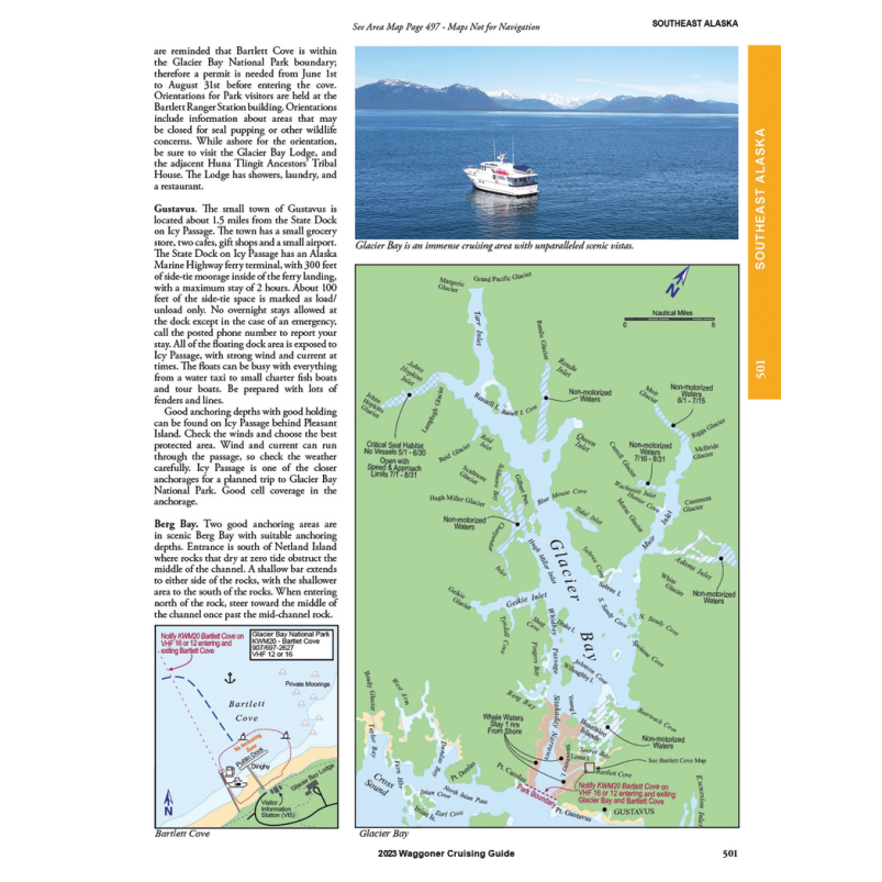
Chapter 1, known as the Compendium, equips boaters with essential information for their journey, covering topics such as regulations, customs clearance, anchoring, weather conditions, and more. Throughout the Waggoner Guide, readers will find engaging sidebar articles that are both informative and entertaining, accompanied by stunning photographs showcasing each cruising area, local attractions, wildlife, and aerial views captured by drones. The Waggoner Cruising Guide is revised and published annually to ensure it contains the most current information available.
Chapter 1, known as the Compendium, equips boaters with essential information for their journey, covering topics such as regulations, customs clearance, anchoring, weather conditions, and more. Throughout the Waggoner Guide, readers will find engaging sidebar articles that are both informative and entertaining, accompanied by stunning photographs showcasing each cruising area, local attractions, wildlife, and aerial views captured by drones. The Waggoner Cruising Guide is revised and published annually to ensure it contains the most current information available.
• 8.5" x 11", 528 Pages, Color, Spiral Bound, Printed in USA
• Fine Edge Nautical & Recreational Publishing
• Inside passage local knowledge
• Border crossing procedures
• Entertaining nautical pet tales sidebars
• 300+ Detailed maps & dock diagrams
• 500+ Marinas & marine parks
• 780+ Anchorages
Specifications
This product can expose you to chemicals which are known to the State of California to cause cancer, birth defects or other reproductive harm.
www.P65Warnings.ca.gov